Research & Reviews: Journal of Ecology and Environmental Sciences
ISSN: 2347-7830
ISSN: 2347-7830
Muhammed Ernur AKINER*
Akdeniz University, Technical Sciences, Campus, Antalya, Turkey
Received date: 10/09/2014 Accepted date: 25/09/2014
Visit for more related articles at Research & Reviews: Journal of Ecology and Environmental Sciences
Within this study, a groundwater model for the town of Amherst, NY was developed. Visual Blue Bird (VBB) model was used for this purpose. Flow is unconfined in the research area. A set of maps that contain rivers, lakes and the county boundary and digital elevation model (DEM) were used for the placement of the surface water features. The main creeks modeled in this study are Tonawanda, Ransom, Ellicott, Got and Black Creek in the Town of Amherst. Effects of urbanization, conditions in pre-development and post-development stages were dealt with. Model Results show that the model is so sensitive on parameters such as hydraulic conductivity, porosity and recharge.
Groundwater model, unconfined flow, urbanization, digital elevation model, Amherst.
In this research, a groundwater model for the town of Amherst, NY is developed. A literature survey was done for this goal and a case study was performed in Visual Blue Bird [4] (VBB) model for the modeling process. Because of this purpose, data in “Town of Amherst Soils and Residential Foundation Study [15]” which is a research report on soils and foundations in Amherst, NY was used. A set of maps that contain rivers, lakes and the county boundary and digital elevation model (DEM) where both spatial coordinates and the altitude are measured in meters, were imported for VBB model and used for the determination of the locations and elevations of rivers and lakes. Since small lakes have insignificant importance with respect to creeks and rivers, no lakes were dealt with. Town of Amherst area boundary (see Figure 1) consists of all analyzed creeks, which are Tonawanda, Ransom, Ellicott, Black and Got Creeks (see Figure 2).

Figure 1: Map of Town of Amherst, Erie County, and western New York.

Figure 2:Map of Amherst, NY, showing Tonawanda, Ransom, Ellicott, Black and Got creeks
Groundwater table elevations in Amherst, NY were compared by ground surface elevations. These elevations were read from the digital elevation model (DEM). Recharge values for both pre-development (natural) and post-development (current) were also calculated.
Aquifer properties such as base elevation, thickness of the aquifer, hydraulic conductivity, and porosity were calculated base on the given report [15] and groundwater engineering books [1,2,3,8]. Base elevation was calculated using the relationship between average earth elevation and the sediment thickness over the bedrock; which is separated in three zones as upper soil zone, middle soil zone and deep soil zone. Hydraulic conductivity is too low in bedrock hence it becomes insignificant for our purpose. The depth to rock is typically 60 to 95 feet below ground surface. In this study for the VBB model it is considered as 95 feet or 28.956 m which is nearly 30 m. The ground elevation varies from about 591 to 603 feet and it is approximately 573 feet above mean sea level. Average groundwater elevation is considered as nearly 600 ft or 180 m. DEM gives average ground elevation nearly as 180m (varies between 175 m and 185 m but mostly 180 m in the centrum), hence base elevation was considered as 150 m (180-30=150 m.) for the model or VBB model analysis. The upper soil zone extends from the ground surface to about six to eight feet below ground surface. The middle zone extends from upper soil zone to the upper till sediment. The deep soil zone occurs from the upper till to bedrock interface.
Soil texture of the Town of Amherst, NY is an expression of the proportion of sand, silt and clay in the soil. Five lacustrine surface soil types in Amherst, NY are Cheektowaga (Ch), Cosad (Cv), Lakemont (La), Niagara (NfA), Odessa (Od, Ut). Common regional descriptions of soils as clay are often simplifications or misinterpretations of the true soil texture. South of the escarpment, soils are mainly silt loam in texture, meaning the soils consist of roughly equal proportions of sand, silt and clay within the surface layer or horizon. North of the escarpment, while often described as clay, surface textures would more accurately be described as silty clay or silty clay loam, although there are still large areas of silt loam and smaller pockets and bands of sandy loam and other textural groups [15]. Sediment shows sandy properties close to creeks. Hydraulic conductivity of sandy soils or mixture of sand silt and clay soils is between 102 m/day – 10-2 m/day [8]. However soil is not the mixture of sand, silt and clay homogeneously so hydraulic conductivity is considered as very fine sand, silt, loess loam soil and it is between 0.001 cm/s – 10-6 cm/s [2]. In this study hydraulic conductivity was considered as 0.001 cm/s or k=0.86 m/day. Porosity for this kind of soil is considered as 0.3 [-] [3]. Erie County’s soils have been mapped and their characteristics described by the National Resource Conservation Service (NRCS, formerly Soil Conservation Service, or SCS) since the early 1970’s [15].
There is no significant pumping well for injection or extraction or no discharge in the far field. Buffalo Airport (1971-2013) Weather Station [11] gives the average annual precipitation 40.5 inches, which is uniformly distributed throughout the year. The average annual snowfall for Buffalo is 97.0 in. During the summer growing season, the potential evaporation is about 25.7 in. According to the given data, total precipitation for Amherst area was considered as 38 in/yr. Calculation given in Table 1 shows that only 16 % of this value recharges to the underground. Hence, annual recharge value becomes 6 in or daily groundwater recharge of the aquifer is N = 0.0004 m/day.

Table 1: Western New York Water Budget.
Significant land use changes have been occurred in the post-development. Recharge to the ground rates and moisture content of the soil were decreased. Reasons for this issue are increase in impermeable cover and sump pumps operations, where the pump placed inside a sump to remove the excess water that has been collected there. It is used especially for basement water level control. It is assumed that there is no significant impermeable cover in pre-development. Hence in order to find the groundwater properties, such as post-development water table, decreased recharge rates can be calculated by using current impermeable cover area. Total occupied land area is 26,380 acreage and approximately 77.4 % of the Amherst area has impermeable cover and 45 % of the town is residential area (see Table 2). In other words 22.6 % of the town has fully permeable cover. Approximately 27% of all inspected homes have detached downspout/gutter systems that discharge water onto the backfill soils adjacent to basement walls. Hence, 27 % of 45 % area or 12.2 % of the impermeable area in Amherst can also be defined as permeable cover. So if we add 12.2 % to 22.6 %, total percentage of the permeable cover is found as 34.8 %. In other words decrease in recharge rate is specified as 65.2 % (100 %−34.8 %). Hence due to increase in impermeable layer, daily decrease in recharge is 0.00026 m/day (0.0004 × 0.652); it is very high compared to 0.0004 m/day recharge.

Table 2:Land use changes in Town of Amherst (1972-2010).
There are 43,000 parcels and each of them covers 600 ft2 or 55.75 m2. Sump-pump rate for a single house is considered as 15 gallons per hour per house or 1.63 m3/day/house. Hence total volume of pumped water is 70,090 m3/day (43,000×1.63). Total area of the Amherst is given as 5,693,043 acreage (all Land-Use types are included) or 23,038,927,627 m2 (see Table 3). Hence due to sump-pump, daily decrease in recharge is 0.000003 m/day (70,090 ÷ 23,038,927,627), which is very insignificant in comparison with 0.0004 m/day recharge. If the effect of increase in both impermeable cover and sumppump are envisioned, total decrease in daily recharge rate and recharge in post-development becomes 0.000263 m/day and N = 0.000137 m/day, respectively.

Table 3:Comparison of actual flow rates with model results.
Recharge rate for groundwater mounding can be calculated numerically by using Equation 1. For unconfined flow, it is assumed that two parallel rivers have the same head, in other words Φ1 = Φ2 = Φ0
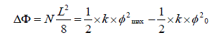 (1)
(1)
As seen in Equation 1 there are two unknowns and one equation, N and Φmax are unknowns, k is hydraulic conductivity and L can be defined as approximate distance of the surface water features or creeks, L is measured as 2000 m - 3000 m. In this point VBB model is introduced for the solution.
Sensitivity analysis is used to ascertain how a given model output depends upon the input parameters. This is an important method for checking the quality of a given model, as well as a powerful tool for checking the robustness and reliability of its analysis [7, 11, 14].
The base elevation affects the total amount of water flowing through the domain since it is unconfined, because it determines the height of a column of water in modeled aquifer. Aquifer thickness determines the quantity of water flowing through an aquifer. In a fully unconfined system, specified thickness has no effect [5]. Since our aquifer is unconfined, thickness has no significant effect.
Background conductivity controls the velocity of water movement. In a model without inhomogeneities, aquifer conductivity will affect only the flow velocity, but not the head contours [5, 6,13]. In our system conductivity has significant effect on head contours if model is not created properly. Porosity has an effect upon the travel times of particles, flow rates in the model [6, 12,13].
The model quality is checked by comparing the predicted elevations with earth surface elevations and by comparing predicted stream flows with actual flows. Actual mean flow rates [9,10] are compared using flow rate values in extract data of the VBB model (extract.dat).
Model quality is also checked by the model checker of VBB in terms of improper intersection of elements, unagreeable specified heads, ineffective elements, polyline and polygon segments with zero length, poor model design such as improper use of far field properties, net extraction in a system without sinks or sources of water, no uniform flow in a model without sinks or sources of water. VBB also checks for heads or river bottoms below the aquifer base, improper implementation of resistance lakes, and calibration in a system without data points [4].
According to the analysis results of the VBB model, results of pre-development and post-development stages were examined through the comparison of specified heads with ground surface elevation (see Table 3).
The groundwater model for the town of Amherst, NY is developed using Visual Blue Bird (VBB) model. Conditions in pre-development and post-development stages are dealt with. Groundwater head values were compared with earth surface elevations, in several locations, comparisons were given for pre-development stage (N=0.0004 m/day) and for post-development stage (N=0.000137 m/day). Sample groundwater mounding for both pre-development and post-development stages are shown within this study. Comparison of actual flow rates with model results, groundwater mounding for pre-development stage (N=0.0004 m/day) and for post-development stage (N=0.000137 m/day) were also calculated. Actual flow rate values were found very close to the model results for post-development. But they were tolerably different than the model results. Since only two main reasons for moisture decrease in soil were dealt with and since selected recharge was an approximate value, these would be the reasons for the tolerable difference. Flow rate values for pre-development (N=0.0004 m/day) were very high compared to both post-development (N=0.000137 m/day) and actual flow rate values. Actual flow rates represent current situation in other words post-development. The model is so sensitive on parameters such as hydraulic conductivity, porosity and recharge. Model is quite successful in terms of predicted elevations using earth surface elevations and predicted stream flows using actual flows.